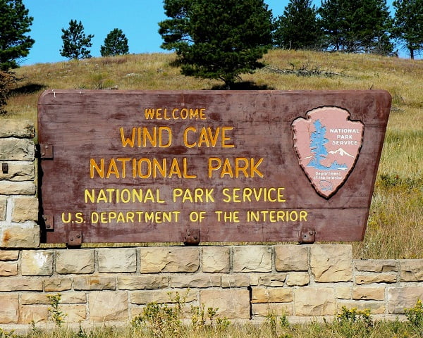
Wind Cave National Park Information Page

Welcome to the Wind Cave National Park Information Page.
Here you will find all you need to know about the natural history of the park.
Learn about the geology, trees, mammals, birds, or other plants and wildlife of the area.

-SPONSORED LINKS-
Rapid City Lodging
Rapid City Hotels
Rapid City Maps
Rapid City Camping
Rapid City Weather
Rapid City Vacation Rentals
Bison Calf

Sponsored National Park Search

Buffalo Calf by John W. Uhler

Wind Cave National Park Information

  • Cave Exploration History
  • Civilian Conservation Corp
  • Cave Meterology
  • Establishment
  • Fire Ecology
  • Geology
  • History of the Black Hills
  • Paleontolagy
  • Questions and Answers
  • Size and Visitation
  • Time Line
  • The Cave Develops

  • Establishment

    On 03 Jan 1903, President Theodore Roosevelt signed the bill creating Wind Cave National Park. It was the seventh national park and the first one created to protect a cave. The parklands at that time were small and there were no bison, elk, or pronghorn. They came later as the park boundaries expanded.

    In 1912, the American Bison Society was looking for a place to reestablish a bison herd. Because of the excellent prairie habitat around the park, a national game preserve was established bordering Wind Cave. It was managed by the U.S. Biological Survey. In 1913 and 1914, the animals began to arrive. Fourteen bison came from the New York Zoological Society, twenty-one elk arrived from Wyoming and thirteen pronghorn came from Alberta, Canada.

    In July of 1935, the game preserve became part of Wind Cave National Park. During the early years of the preserve, the animals were kept in small enclosures. Eventually, it was realized that they needed more space. The bison and elk needed additional forage and the pronghorn needed room to escape from predators. With the help of the Civilian Conservation Corps (CCC), fences within the park were removed. And in 1946, 16,341 additional acres were added, enlarging the park to 28,059 acres.

    During the 1950's and 60's, park wildlife was the focus of much attention. Because of the lack of large predators, like wolves and grizzly bears, the bison and elk herds had grown to the point that they were literally "eating themselves out of house and home." Park rangers began to evaluate the carrying capacity of the park. Carrying capacity is the number of animals that can exist in a habitat without damaging it. To solve the problem of overgrazing, the bison and elk herd sizes were reduced. Park rangers began an active program to manage the herd size. They began rounding up the animals and shipping the excess live from the park to other parks and reserves. Rangers also worked to improve the grassland by reseeding overgrazed areas with native grasses and controlling exotic plant species.

    In the 1970's and 80's, managers continued to focus on caring for the wildlife and rangeland by building an understanding of how the natural systems should function. The reintroduction of fire as a natural means to improve the range and to limit the expansion of the forest onto the prairie was researched. An active fire program was started, with the first prescribed fire occurring in 1972.


    Size and Visitation

    Gross Area Acreage = 28,295

    Wind Cave National Park is open year round with visitation the highest in June, July and August and lowest in December, January and February.


    Time Line of Events

    10 Aug 1912 - National Game Preserve was established and a national range for a herd of bison to be presented by the American Bison Society was established.


    04 Mar 1931 - Park boundaries were expanded by 1,200 acres to provide water resources for the reserve's wildlife.
    28 Aug 1931 - 101 acres, 10-foot right-of-way and access easement for domestic water supply deed was purchased.
    01 Jul 1935 - The National Game Preserve was abolished, transferring the land to Wind Cave National Park.
    16 Jun 1938 - The Surplus Wildlife Disposal Act authorized the Secretary of Interior to sell or otherwise dispose of surplus buffalo and elk and also stated the all monies received from the sale would be deposited in the US Treasury as miscellaneous receipts and that most of the surplus animals would be given to Indians or charitable institutions for food or for starting herds of their own.
    09 Aug 1946 - Wind Cave National Park was expanded from 11,718 to 28,059 acres from former Recreation Demonstration Lands, conveyed Section 25 to the State of South Dakota as State School Lands and provided for a minimum of 10,000 gallons of water per day to pass from Custer State Park to Wind Cave National Park.
    10 Nov 1978 - Boundary expansion added approximately 232 acres to the southern boundary with Congress appropriated funds in 1980 and 1987. The property was purchased in November, 1987 and was subject to egress and ingress and a right-of-way easements.
    08 Mar 1947 - Highways were relinquished to US use, construction and maintenance of the portions of public highways within Wind Cave National Park and ceded the jurisdiction of the highways to the US.
    27 Feb 1980 - Concurrent jurisdiction was ceded to Wind Cave National Park, Mount Rushmore National Monument, Badlands National Park and Jewel Cave National Monument and was accepted by the National Park Service through a letter to the governor.


    Geology

    The Landscape

    The landscape of Wind Cave National Park is formed by the rock types, their structure, and how they were weathered and eroded. Gently tilting layers of sedimentary rocks lie under most of the park.

    The Oldest Rocks

    The oldest rocks are exposed in the northwest part of the park. These are schists and pegmatites. The schists are metamorphic rocks which formed under heat and intense pressure during an early episode of mountain building, about 2 billion years ago. They have almost parallel bands, or foliation, caused by the growth of mica crystals under pressure.

    Pegmatites are made of large crystals of glassy-gray quartz, pink feldspar, silvery micas, and shiny black tourmaline. Pegmatite is an igneous rock, similar to granite. It hardened from magma and hot fluids. In places, the pegmatite intruded into the schists. This proves the pegmatite is younger than the schists, but still very old at 1.7 billion years. The emplacement of the pegmatite probably occurred during another mountain building event.

    Sedimentary Rocks

    To the southeast of the igneous and metamorphic rocks, progressively younger layers of sedimentary rocks are at the surface. They span a time from the origin of abundant sea life, about 600 million years ago, to the end of the age of dinosaurs, about 60 million years ago. During these years, seas advanced and retreated over this region many times. Periods of deposition of sediments alternated with periods of erosion. About 65 million years ago forces within the earth produced another period of mountain building, raising the "modern" Black Hills.

    Shaping the Landscape

    Since that uplift, weathering, erosion and minor uplifting have been shaping the Black Hills. Sediments produced by the erosion filled some valleys within the park and spilled outside the Hills to the east, forming the layers now visible at Badlands National Park. Rocks more resistant to weathering and erosion, like pegmatite, limestone, and sandstone, form ridges or plateaus. Weaker rocks, like schists and shales, form valleys. Examples of limestone, sandstone and shale are visible in Beaver Creek Canyon, Wind Cave Canyon, and Red Valley. Schists and pegmatites are visible along Highway 87.

    The Pahasapa Limestone

    Wind Cave formed in the Pahasapa Limestone. This limestone was deposited in a warm shallow sea about 350 million years ago and is composed mostly of fragments of calcium carbonate sea shells. Coinciding with the accumulation of limestone, bodies of gypsum (calcium sulfate) crystallized from the sea water, when arid conditions caused evaporation. The gypsum formed irregular shaped masses within the limestone.

    The Role of Gypsum

    The gypsum masses were unstable. Their volumes increased and decreased as they absorbed and expelled water. This caused fracturing to occur within the gypsum and in the surrounding limestone. Like thick toothpaste, some gypsum squeezed into these cracks and crystallized. At a later time, water rich in carbonate ions converted all of the gypsum to calcite (calcium carbonate). This set the stage for the cave and boxwork to form.


    The Cave Develops

    Since acid-rich water dissolves limestone, a chemical change in the groundwater had to occur for the cave to form. The oceans receded allowing fresh water into the region. As gypsum was converted to limestone, sulfur was chemically freed to form either sulfuric or sulfurous acid. These acids dissolved the limestone to form the first cave passageways some 320 million years ago.

    After the first period of cave formation, seas again advanced over this area. About 300 million years ago, layers of red clay, sandstone and limestone of the Minnelusa Formation were deposited above the Pahasapa Limestone. Some of this sediment washed into and filled early-formed cave passageways. These "paleofills", are visible in higher levels of the cave, near the Garden of Eden and Fairgrounds rooms.

    A Complex Cave

    Seas continued to advance and retreat over the area for the next 240 million years. Deposition of sediment alternated with erosion. Development of the cave was probably slow until the most recent Black Hills uplift about 65 million years ago. This opened more fractures in the limestone allowing more cave to form. The waters that made the cave probably sat in the limestone for long periods of time. Water did not flow through the cave like a river. The water had plenty of time to dissolve passageways along the many small cracks, thus developing the complex maze-like pattern.

    Boxwork

    Slow moving water was also important in exposing boxwork. At the edges of the former gypsum masses where the expansions had formed cracks, limestone was dissolved. This dissolving of the surrounding limestone, left the previously deposited crack fillings standing in relief. These exposed crystal fins are called boxwork. A river might have eroded boxwork from the cave.

    Where is the Water Now?

    Geologists believe that the water began slowly draining from the cave 40 to 50 million years ago. Today the water level is about 500 feet below the surface at an area named "the Lakes". Water, however, is still changing the cave. Slow seepage of water produces frostwork and popcorn on cave walls and ceilings. Formations that need more water, like flowstone or dripstone deposits (stalactites and stalagmites), are rare in Wind Cave and are limited by the dry climate and semi-permeable clay beds above the cave.

    A Very Unusual Cave

    Wind Cave is over 300 million years old, making it one of the oldest in the world. Besides extreme age, other features make Wind Cave unique. The cave is large and extremely complex, the 81 miles of known cave (1998) fit under one square mile of land. The boxwork is rare and found in few other caves. Wind Cave has undergone many geological changes and the processes continue. Geologists have many questions yet to answer before we can fully understand the rich, incredible world below our feet.

    Speleothems

    The different types of features that decorate the cave are collectively called cave formations or speleothems.

    Most of the speleothems in the cave form by similar process. The water passes downward through the soil above the limestone, absorbs carbon dioxide, and becomes acidic. As a weak acid, the water is able to dissolve a small amount of the limestone rock as it passes through cracks and pores on its journey down into the cave. As this water drips into the air-filled cave, dissolved carbon dioxide is given off. Because the water has lost carbon dioxide, it cannot hold as much dissolved calcium. The excess calcium is them precipitated on the cave walls and ceilings to make up many of the different kinds of formations. Most calcium is precipitated in the cave as the mineral calcite (CaCO3).

    There is, however, considerable variation in the types of calcite crystals that form even if the process of their crystallization is roughly the same. Small, knobby growths of calcite on the cave calls are called cave popcorn. Popcorn commonly forms in one of two ways in the cave: where water seeps uniformly out of the limestone wall and precipitates calcite; or, when water drips from the walls or ceilings of the cave and the water splashes on the floor or on ledges along the walls. This splashing action causes loss of carbon dioxide and the subsequent precipitation of calcite.

    Delicate needle-like growths of calcite or a related mineral, aragonite, are called frostwork. In places the frostwork may grow on top of cave popcorn or boxwork. The origin of frostwork is controversial. In Wind Cave, it seems to concentrate in passages with above average airflow where, it is thought, evaporation plays a role in its formation.

    Where the deposition of calcite is concentrated along cracks, calcite is deposited as flowstone, or dripstone. Dripstone includes such features as stalactites and stalagmites, speleothems common in many limestone caves but relatively rare at Wind Cave. The comparative scarcity of these features in Wind Cave is another puzzle for geologists. Perhaps a lack of water would explain it. Alternately, the difference may be the way the water passes through the rock. Rather than just flowing along cracks, much of the water which enters Wind Cave today passes more-or-less uniformly through the rock by seeping between pore spaces. Consequently, when the water reaches the cave it coats the cave walls with a frosting-like layer of calcite rather than concentrating the calcite only along cracks.

    Certainly one of the most curious formations in Wind Cave are helictite bushes. While small helictites are found in many caves, the helictite bushes are large, bush-like growths of calcite that branch and twist like gnarled trees. The largest helictite bush in the cave is about 6 feet tall. The helictite bushes usually grow from the floor of the cave. The helictites may form when water seeps into the cave through pores so small that the flow is controlled by capillary action and not by gravity. This allows water to move uphill and deposit calcite against the force of gravity. It is also thought the bushes may have formed underwater when the water rising form below mixed with cave waters of a different chemistry.

    Other types of speleothems are found in the cave. Calcite rafts are thin sheets of calcite that today are precipitating and floating on the surface of Calcite Lake in the deepest part of the cave. The thin rafts float on the surface due to surface tension before eventually sinking when they become too heavy or when the pool is disturbed. Calcite rafts which litter the floor of some dry areas of the cave are evidence that these passages were once flooded too.

    Gypsum crystals are common in some of the dryer parts of the cave. Gypsum, a mineral containing both calcium and sulfur, sometimes takes the form of needle-like crystals that radiate from clusters on the floor of the cave; in other cases, gypsum resembles puffs of cotton, or forms clusters of curved or coiled crystals called gypsum flowers.

    Spear-shaped crystals of calcite called dogtooth spar frequently line small pockets in the limestone rock. These crystals are a prominent feature of other caves in the Black Hills, most notably, Jewel Cave of Jewel Cave National Monument.

    While many speleothems have formed as water has dripped into the passages, the most conspicuous feature of Wind Cave, boxwork, has probably formed differently. Boxwork is found in small amounts in other caves, but perhaps in no other cave in the world is boxwork so well-formed and abundant as in Wind Cave. Boxwork is make of thin blades of calcite that project form cave walls and ceilings, forming a honeycomb pattern. The fins intersect one another at various angles, forming "boxes" on all cave surfaces. Boxwork is largely confined to dolomite layers in the middle and lower levels of Wind Cave.

    The origin of boxwork remains one of the biggest mysteries of Wind Cave. Recent research suggests that the boxwork fines once filled cracks in the dolomite rock long before Wind Cave even existed. As the walls of the cave began to dissolve away, the vein and crack fillings did not, or at least dissolved at a slower rate than the surrounding rock, leaving the calcite fins projecting from the cave surfaces. The dissolution may have been accomplished by water that flowed very slowly through the cave. The water became saturated with calcium carbonate quickly, but remained unsaturated with magnesium carbonate (the dolomite). Thus as the water moved through the cave it dissolved the dolomite surrounding the boxwork fins, but was unable to dissolve the boxwork, leaving it projecting into the cave rooms. This theory would help explain why dolomite usually a less soluble rock than limestone, would dissolve at a faster rate than the calcium carbonate boxwork fins. The water thus began to immediately dissolve the dolomite around the calcite-crack fillings and isolated them as boxwork. Others feel that the exposure of boxwork fins is the result of weathering actions taking place in the cave even today. Perhaps as big a question as the development of the boxwork is the origin of the cracks that the boxwork fins filled.


    Paleontology

    Millions of years have passed in the history of South Dakota and, as time has passed, the plants, animals, climate, and topography have changed. Fossil records along with geological records hold information hat help paleontologists explain these changes. The geological record tells us how the surface of the earth was transformed, which helps explain the changes in the climate. These changes, in turn, affect the composition and distribution of the flora and fauna found in North America. Rock layers which preserve the fossil record can also provide clues to the prehistoric sequence of events. As we study the past, we find explanations for the current plant and animal composition of the Black Hills and the surrounding plains.

    Precambrian Era

    During the Precambrian Era, the earliest period in geological time, the Black Hills region was covered by a vast sea which deposited sediments for millions of years. Sedimentary rocks of the Precambrian include shale, sandstone, and limestone. Igneous rock, now exposed at the core of the Black Hills, were formed deep below the surface.

    Origin of life

    Life first stirred in the vast Precambrian seas. Life began as single-celled and noncellular organisms, resembling modern day bacteria and algae. Multicellular forms evolved from these first organisms.

    Paleozoic Era

    When compared to the Precambrian Era, the fossil record of the Paleozoic Era represents an explosion of activity. During this time most of the major plant and animal groups appeared. Since the North American continent was near the equator, the climate was warm and tropical. For much of the Paleozoic Era, the Black Hills region was covered by shallow seas.

    Age of Fish

    Early in the Paleozoic Era, marine life was dominant. Some marine species developed hard outer coverings. Trilobites, early arthropods with exoskeletons and jointed appendages, were numerous. Shellfish, like crabs and snails, were found along with soft bodied jellyfish. As the shelled marine animals died, their shells settled on the sea floor, dissolved, and were compressed forming layers of limestone. Some of the shells of these invertebrates were preserved intact. Fossilized brachiopods and mollusks are found in the Pahasapa Limestone which was deposited in the Black Hills region during the Mississippian Period. Silica from sea dwelling diatoms and sponges may be responsible for the chert nodules found within limestone. Fossilized plants of the early Paleozoic were calcareous algae and lichens. As life in the sea continued to expand, life emerged on land.

    Sea levels fluctuated greatly during this time. The emergency of land permitted sea plants to migrate to this new habitat, followed by sea animals. The first fossil evidence of land plants are fragmentary remains dating to the Silurian Period. Dominant land plants include club mosses and members of the psilophytes, which are believed to be the ancestor of the ferns and the flowering plants. Primitive amphibians were the first land animals.

    Vast tropical lowlands

    Toward the end of the Paleozoic Era, North America was part of a vast tropical lowland. The forest was dominated by horsetails, tall lepidodendroid trees with long grass-like leaves, ferns, and the earliest conifers. In South Dakota, the earliest evidence of the palm-like cycades is found in the Minnekahta Limestone.

    At the close of this era, many plant and animal species became extinct. Absent in the fossil record of the next era are trilobites, certain brachiopods, most horsetails, and many ferns.

    Mesozoic Era

    Age of Reptiles

    Reptiles dominated the Mesozoic Era. The first dinosaurs appeared very early in the Mesozoic and became abundant by the end of the Triassic Period. By the close of the Mesozoic, they were gone, and other much smaller reptiles, like turtles and crocodiles remained.

    Fossil records from the Cretaceous Period, most of which are found in the Badlands, give us a glimpse of this period. Shallow seas covered the continent. Large marine reptiles like the Alzadasaur, of the suborder Plesiosauria, hunted fish in these waters. Also present were Xiphctinus, an early members of the teleost fish group which today includes salmon. Herperornis, a large flightless bird, plunged underwater using powerful legs to propel itself forward in pursuit of a meal. With a 25 foot wingspan, the giant Pteranodon flew overhead. Snails and clams lived on the muddy sea floor. Sea turtles remains have been found near Buffalo Gap. In the Badlands to the east, the remains of octopus-like ammonites have been uncovered.

    Ancestral Rocky Mountains

    During the Pennsylvanian Period, the ancestral Rocky Mountains rose and were erodes down again. Streams and rivers carried sediment from these mountains east to the plains. When the interior of the North American continent rose, a sea floor rich in alluvial sediments were exposed. These fertile plains supported an abundance of life in the cretaceous Period. Cycads were present, as well as the sequoia tree, whose fossils have been found near Black Hawk, South Dakota. The lush vegetation provided food for Triceratops that roamed these plains.

    At the end of the Mesozoic Era, the large reptiles, including the winged pterodactyls and marine plesiosaurs, vanished. Small mammals, the ancestors of the insectivores and the marsupials, had evolved during the Jurassic. With the demise of the dinosaurs,the mammals became more abundant and diversified during the Cenozoic Era, the "Age of Mammals."

    Cenozoic Era - Age of Mammals

    As continental plates collided, the Rocky Mountains uplifted during the Laramide Orogeny, a process that lasted 55 million years. The uplift of the Black Hills started between the final stages of the Cretaceous and Paleocene, and continued until a final uplift occurred during the Pleistocene.

    As the mountains rose in the west, the interior climate changed. With each pulse upward, the Rocky Mountains collected more and more of the available moisture. The air continuing east brought less precipitation to the plains region. As the North American continent moved northward away form the equator, temperatures decreased and seasonal variations in climate increased. In Cenozoic times, the North American climate was warmer than present, though cooler and drier than during the Mesozoic. This climate trend brought some species to extinction and allowed northward colonization for others. Plant species and plant communities became increasingly like those of the present.

    Paleocene and Eocene Epochs

    During the early Tertiary Period (Paleocene and Eocene Epochs), North America's climate was semi-tropical. Broad-leafed evergreen forests with palms flourished. Four-toed Eohippus horses consumed the soft leaves and shoots, using teeth adapted for such succulent vegetation.

    Near the end of the Eocene the climate became cooler and drier. Plant communities were becoming less tropical. Grasslands were present, though their distribution was limited. This arid trend persisted into the Oligocene Epoch. Savannah-type habitat replaced the denser forests. Rivers and forested river bottoms traversed the land. The landscape of the Oligocene accommodated many species of animals. The titanotheres, huge beasts with large, long horns on their snouts, browsed in the forested drainages and grazed in the rising grasslands. Swift herds of oreodonts, small sheep-sized mammals with fang-like teeth, browsed in the savannas. The Oligocene horse, Mesohippus, possessed three-toed feet which enabled it to walk on the soft soil in river bottoms and glades. The saber-toothed cat preyed upon the small, but fleet Mesohippus. Lizards and snakes were present. Land turtles fed on the abundant plants surrounding ponds.

    Miocene and Pliocene Epochs

    The trend toward a more arid climate continued during the Miocene and Pliocene Epochs. The Rocky Mountains were nearly at their highest elevation and intercepting most of the moisture from the Pacific. The Miocene plant community looked more like today's plant community. In the Northern Great plains region, grazing and browsing mammals were found together in savanna-type habitat. The titanotheres were extinct. Horses, rhinoceros, and camels inhabited the savannas, meadows, and wooded streams. Catfish, frogs, turtles, and beavers were present in the scattered ponds.

    Pleistocene and Holocene Epochs

    The Pleistocene Epoch began two to three million years ago and ended around 10,000 years ago. This was the "Ice Age", when glaciers advanced and retreated across the North American Continent. Glacial advances displaced vegetation zones to lower latitudes and lowered the range of forests in the mountains. Seasonal variation was less extreme. The composition, diversity, and structure of North America's modern plant and mammalian communities were shaped by the end of this time period.

    Much of the information concerning the composition of the rising Great Plains plant community is from the last glacial episode. The last continental glacier reached it maximum 12,000-14,000 years ago. The Black Hills region was never glaciated, but the continental ice sheet came within 150 miles, reaching what is now the Missouri River. Spruce forests were present in park-like stands across South Dakota. The Mammoth Site in Hot Springs has evidence of a plant community that has been described as a cold steppe-grassland with rare scattered trees. Though most of the vegetation consisted of grasses and sedges, there were many other species represented. These included saxifrage, parsley, mustard, sagebrush, spruce, birch, juniper, and oak. Some mammals associated with the Black Hills included the mammoth, peccary, wolf, coyote, and the giant short-faced bear.

    End of the Ice Age

    When the last continental ice sheet retreated, the Northern spruce gradually followed northward. Some remained as relict stands in suitable habitat in the canyons and the valleys of the Black Hills. Pines slowly migrated to the Black Hills from the west. Early Holocene shortgrass prairie can be found just southwest of the Black Hills and contains grass species that are also located in the high altitude in the Black Hills. During the Holocene Epoch, a period of extreme arid conditions known as the Altithermal contributed to the rise of more drought tolerant plants, like blue grama and buffalo grass. The vast grassland plains expanded during this period. As the spruce declined, the more xeric ponderosa pine became dominant.

    As the composition and distribution of vegetation changed, the distribution of animals also changed. Ranges of many species moved northward with the retreating ice sheet. Animals that could not digest the new coarse vegetation of the grasslands, like the horse, mammoth, rhinoceros, and camel became extinct in North America. Other species, like the bison, deer and elk, moved into the available habitat and survived.

    Humans arrive

    Humans entered the picture in South Dakota during the Pleistocene. Paleontologists debate the possible influence that humans had on the extinction of large mammals like the mammoth. The theories range from the loss of habitat and the decline of forage to over-hunting by man.

    The plant composition and distribution of today resulted from the changes in climate, the ability of species to take advantage of newly opened spaces, and the rate of plant population migration. The Black Hills region had an array of habitats available for plants to establish themselves. Animal species adapted to the changing plant community, migrated, or became extinct. Many plant and animal species from the north, south, east, and west that had migrated into the South Dakota region remained. Today the Black Hills is a place of great biodiversity because of this past.

    The environment of the present will one day be the paleontology of the future. The topography, climate, and wildlife and plant distributions are still changing.


    Cave Meteorology

    It has long been thought that caves possess constant temperatures and humidity; never changing, even during periods of extreme temperature fluctuation on the surface. Although this may be true in very remote parts of large cave systems, most caves exhibit enough variation in this respect to warrant serious investigation. Such an investigation took place at Wind Cave during 1984 and 1985. What follows is a summary of what was learned in this study, together with some information on the role cave climate plays in the overall cave environment.

    Cave Weather

    Weather can be defined as the present state of the atmosphere in an area with respect to heat, wind, pressure, and moisture. Of these, heat is the most important since changes in heat quite often bring about changes in the others. On the surface, weather is driven by the sun, which heats some areas of the earth more than others. Temperature differences lead to pressure differences which lead to winds and precipitation. But what are changes in the weather of a dark, sunless cave caused by? To understand, we must first look at how heat enters the cave.

    Significant amounts of heat can enter a cave in four possible ways. Heat may enter from the overlying rock, from the underlying rock, from air flowing into the cave, or from water flowing into the cave. We will look at each of these four possibilities, and discuss how each affects the weather in Wind Cave.

    First, let's look at how heat enters the cave from the rock above it. The flow of heat through the sandstone and limestone overlying Wind Cave's passages is extremely slow. Temperature fluctuations of over 60�F between day and night are not uncommon on the surface, but if we were to monitor the temperature only two feet below the surface on such a day, the fluctuation in temperature would be only about 1�F. Therefore, it does not stay warm long enough during the day, nor does it stay cool long enough during the night, to significantly change the temperature of the rock only two feet underground. The same principle holds true for seasonal temperature fluctuations as well, although the depth at which temperatures begin to stabilize is greater. Seasonal temperature fluctuations of 80�F are reduced to only l�F at a depth of about 50 feet. So if a cave's only source of heat was from the overlying rock, its temperature would approximate the mean annual surface temperature for its area. It appears this is rarely the case. At Wind Cave for instance, the mean annual surface temperature is 47�F, yet the temperature in most parts of the cave (away from the tour routes) is 55�F. Where is all this extra heat coming from? The answer appears to be from below!

    Since the interior of the earth is a tremendously hot, molten mass, one would naturally assume that temperature would increase with depth below the surface. This change in temperature with depth is known as the geothermal gradient. In areas where the geothermal gradient is low, cave temperature is influenced mostly by the mean annual surface temperature. In areas with high geothermal gradients, cave temperature is influenced by the mean annual surface temperature and by heat from below. Caves in areas such as this tend to be warmer than the mean annual surface temperature. This is apparently the case at Wind Cave. The same geothermal gradient which is responsible for the warm waters of Hot Springs is heating the cave!

    Caves with no connections to the outside world have no further sources of heat. Since the heat supplied by the rock is provided very evenly, and since changes in the amount of heat reaching the cave can only occur over very long periods of time, the weather in such caves is very constant. But caves with open connections to the surface have two more possible sources of heat which can alter the weather inside the cave: airflow and water. Both are capable of transporting outside conditions into the cave environment.

    The effects of water on the cave temperature at Wind Cave are very slight. Water dripping into the cave normally has reached rock temperature by the time it reaches the cave atmosphere, so little heat exchange can take place. But in caves with active streams flowing in from the surface, large seasonal fluctuations in temperature can occur very deep into the cave, since it takes a long time for the water to heat or cool to cave temperature.

    The real weather (i.e. daily changes in the cave's atmospheric conditions) of Wind Cave is driven by the wind. Few caves experience the volume of airflow which Wind Cave exhibits. On average, almost 1,000,000 cubic feet of air enter or leave the cave per hour when the Walk-In Entrance is open! That's enough air to completely fill a cave 10 feet wide, 10 feet tall, and almost 2 miles long! Since it takes a long time for a volume of air this large to warm or cool to cave temperature, temperature changes can occur surprisingly deep into the cave on days when the cave is inhaling. The Wind Cave Climate Study of 1984-85 showed that with the Walk-In Entrance open in the winter, temperatures could fluctuate by over 12�F as far into the cave as the Post Office (over 500 feet from the entrance). The entire Half-Mile Tour route is almost always cooler than the 55�F deep cave temperature, mostly due to cold air brought into the cave during the winter. So much for constant temperatures at Wind Cave!

    Not only does inflowing air affect cave temperature, but it also affects cave humidity. The same study showed that humidity was lower whenever the cave inhaled. Natural cave humidity is probably about 95%-100%. Cold air is usually dry, and when it enters the cave environment and warms it becomes even drier. Some areas showed humidity as low as 60% on days when the cave inhaled. Humidity did not stabilize until the Temple was reached, over 2000 feet into the cave. This drier air evaporates water from the cave environment, further cooling the cave since evaporation requires large amounts of heat.

    Cave Climate

    Cave climate is concerned not with the present conditions of the cave atmosphere, but with the average conditions over a period of time. At one time (prior to 1890) the only significant opening to the surface at Wind Cave was the blowhole near the Walk- In Entrance. The construction of man-made entrances allowed for a huge increase in airflow into and out of the cave, bringing with it changes in the cave climate. What follows are a few examples of how the fate of both the cave and its fragile ecosystem are intertwined with changes in the climate of the cave.

    The greatest harm to the cave itself may come from the evaporation which takes place in the winter. Many of the cave's speleothems are directly dependent upon the amount of water available. Stalactite growth may be slowed or even stopped when less dripping water is available. There is also considerable evidence which shows that aragonite (present in Wind Cave in the form of popcorn or frostwork) tends to form in preference to calcite in areas with high evaporation rates. Thus, a change in cave climate can change the very chemical structure of the speleothems themselves!

    Cave fauna will also be disturbed by a change in the cave climate. Animals which have evolved in the cave's environment over thousands of years will probably have little tolerance for major temperature changes. Many of these animals live on moist surfaces. When evaporation takes place on these surfaces it can become remarkably cool. Different species of bats prefer different environments in the cave for roosting and they also could be disturbed by a change in the cave climate.

    Charles Dudley Warner once said, "Everybody talks about the weather, but nobody does anything about it". Unfortunately, he was right, at least as far as outside weather is concerned. But we really can do something about the weather in a cave. It is simple for us to alter it, and it is possible for us to restore it to its natural state. Our actions will have remarkably profound effects on the future of the cave!


    Fire Ecology in the Black Hills

    Perhaps the most significant ecological change that man has initiated in the Black Hills has been the suppression of wildfire. Pictures taken during the Custer exploratory expedition of 1874 show clearly that the hills had a much less dense growth of ponderosa pine. When people began suppressing wildfires, a natural thinning process was stopped and the ponderosa began to encroach upon the prairie. In fact it was more dramatic than that. The ponderosas grew like weeds in the Black Hills.

    As so often happens when people change the natural order of things, the ecological balance was upset. In many areas where we once had a greater variety of vegetation, more grasses and forbes, we now have a monoculture. In some places the pines grow so dense that the forest floor doesn't receive enough sunlight to support vegetation that would be more beneficial to animal life. Deer, elk, and pronghorn do not get nearly as much sustenance from pine trees as they could from the grasses and shrubs the pine trees have displaced. Other hardwood trees such as the bur oak, American elm, box elder, birch and aspen are also important food sources that have been displaced by the encroaching pine trees.

    Because of increased evaporation from millions more trees it is likely that the streams are not carrying as much water as they did historically. The character of the soil itself is changing.

    Through a program of prescribed burns Wind Cave National Park and other government agencies in the Black Hills are attempting, under carefully controlled conditions, to reintroduce fire as a management tool. Meanwhile because the fuel buildup has been so intense for so long, and because the hills are settled now, wildfire will continue to be suppressed.


    Exploration History of Wind Cave

    Wind Cave has always been a world class natural resource. Yet it was not until explorers first entered, and then continued to push further afield underground, that the significance of Wind Cave began to be realized. Wind Cave is one of the most complex maze caves in the world making it challenging to explore and very easy to get lost.

    Over many years of exploration and mapping Wind Cave has grown to be one of the world's largest known caves and even with 74 miles of passages explored, only a small fraction of what is beneath the rolling hills of Wind Cave National Park has been found. Wind Cave is the fifth longest cave in the United States and eighth longest cave in the world.

    Discovery of the Entrance

    The discovery of the entrance to Wind Cave is shrouded in mystery. Lakota Indian legends speak of a hole in the Black Hills that blows air. There are teepee rings near the present day elevator building. Lakota Indians traveling and living in the Black Hills were probably the first people to actually notice the entrance to the cave. There is no evidence that any of them actually entered the cave.

    The discovery of gold in the Black Hills brought an onslaught of white settlers during 1876 and it was perhaps inevitable that someone would happen upon the entrance to Wind Cave. By most accounts, the "discovery of Wind Cave is credited to Tom and Jesse Bingham during the spring of 1881. Jesse and Tom Bingham, were deer hunting in the area of Wind Cave. They discovered an 12 x 10 inch hole. Air rushing out of the hole knocked the hat right off of Jesse's head. A few days later when Jesse returned to show this phenomena to some friends, he was surprised to find the wind had switched directions and his hat was sucked into the cave. Today, we understand that the direction of the wind is related to the difference in atmospheric pressure between the cave and the surface.

    The first person reported to have entered the cave was Charlie Crary in the fall of 1881. He claimed to have left twine to mark his trail, others entering the cave later found his twine. These early explorers were the first to see a rare cave formation called boxwork.

    In 1890, the South Dakota Mining Co. filed a mining claim for Wind Cave and hired Jesse McDonald as manager. Because the cave had no valuable minerals the company quickly lost interest. Jesse McDonald stayed on as a homesteader and, with the help of his two sons, Elmer and Alvin, developed the cave for visitors.

    Between the time of the Binghams' "discovery" of Wind Cave and 1890 several groups of people were reported to have visited the cave to explore..."the labyrinthine mazes of that attractive wonder..."(Custer Chronicle, July 1886). By 23 Sep 1887 the Hot Springs Star was reporting that Wind Cave had been explored for three miles (5 km) and "no bottom found". Early caves lengths such as this were probably exaggerations of inexperienced cave explorers or of the press.

    Exploration activity took off when J.D. McDonald was hired as manager of Wind Cave by the South Dakota Mining Company in 1890. Fortunately for us Alvin McDonald, one of J.D.'s sons, started recording his exploration trips into Wind Cave. Alvin was the first true explorer of Wind Cave. He had a great deal of enthusiasm and explored the passages around today's tour routes. Alvin's diary describes the explorations in Wind Cave from 1891-1893 by members of the McDonald and Stabler families and people who came to visit the cave. He kept an account of his explorations and activities in a diary, helping us better understand the early history of the cave. On 23 Jan 1891, at the end of a long day, Alvin noted in his diary, "..have given up the idea of finding the end of Wind Cave". Based upon Alvin's writings, signatures, specimen stashes, and artifacts discovered in the cave it is possible to estimate the extent of exploration during this historic period of Wind Cave's history. Despite claims by the McDonald's that the cave had been explored for 97 miles, (156 km), only 5-8 miles (8-13 km) of passages were known by these first cave explorers. The McDonalds' explorations ending in a cavern called Rome.

    Modern Cave Exploration

    Modern cave exploration begins when surveying and mapping begin. The first survey of Wind Cave was begun on 04 Apr 1902. The United States Wind Cave Survey was commissioned by the General Land Office and was done by Maryon Willsie, a surveyor from Rapid City, South Dakota Willsie surveyed 4509.2 feet (1374 m), basically following the current Natural Entrance route to the Assembly Room, out to the Pearly Gates, and up to the Fairgrounds.

    Following the initial flurry of activity in the 1890's, little happened in the way of exploration and survey in Wind Cave for many years. During the Civilian Conservation Corps days, while the trail system was being developed, some additional mapping was done but little in the way of new discoveries was found.

    It was not until the 1950's that surveying was again begun at Wind Cave. Cavers from the Colorado Grotto (1950-1970), South Dakota School of Mines (1955-1963), and the National Speleological Society (NSS) Expedition (1959) began to survey in the Historic zone of the cave. Most of the cave mapped in this area had been previously explored by the McDonalds (principally Alvin) and the Stablers.

    In the 1960's David Schnute was invited to Wind Cave. During their explorations they made an exciting discovery off the room called Rome. He, along with Herb and Jan Conn (who have explored over 60 miles of passage at Jewel Cave) found a tight passage that "spilled" over into miles of passage beyond the previously known limits of the cave. This small passage is known as the spillway. In 1965 the known length of Wind Cave was 10.53 miles.

    In the late 1960's and early 1970's, explorers discovered lakes and larger rooms such as Half Mile Hall. During the summer of 1970, one of the larger lakes was found just beyond previously discovered Calcite Lake. Windy City Lake is two hundred feet long, fifty feet at it's widest and around twenty-eight feet deep. Today the location of six lakes is known. They are approximately 500 feet below the surface, at the water table.

    To this day, explorers are still surveying passages in the Historic zone that had been previously entered as early as the early 1890's. Individuals and groups that have been involved in the survey of the Historic zone of Wind Cave include Alan Howard (1962), Windy City Grotto (1970-1973), National Park Service staff (1971-present), Gartzke-Kopp (Black Hills Spelunkers 1974), Bruce Zerr (1976), the National Outdoor Leadership School (NOLS 1978-1989), and the Colorado Grotto (1990-present).

    In addition to the Conn's western pushes they also found their way out to the Xerox Room. That opened the door to further discoveries by the Colorado Grotto. During the mid-1960's to mid-1970's these cavers pioneered explorations in the Red Crystal Canyon and Atlas Underground Hempworks area. In the past few years these cavers have been the most active mapping group and have added several miles of new passages in the Red Crystal Canyon Area, Historic Zone and Silent Expressway as well as many other areas of the cave.

    The major discoveries by Conn, Conn and Schnute included the route down to Calcite Lake and the Club Room. All of this, and most of the discoveries made at Wind Cave in the next twenty years or so was dependent upon the discovery of the Spillway.

    From 1970 to 1973 the Windy City Grotto, a caving club from Chicago affiliated with the NSS, explored and surveyed in Wind Cave. This period saw over 20 miles (32 km) of passages mapped, most of it previously unknown. Major finds that occurred during this time include Windy City Lake (lowest point in the cave) and Half Mile Hall (the largest room/passage yet discovered).

    For the first time in the history of Wind Cave base camps were used to push further into the cave without having to exit the cave between trips. Two base camps were established (one merely a communication station with telephone to the surface) and used during these explorations by Windy City Grotto members. Although such camps are no longer used in the exploration of Wind Cave (the person-power to establish and stock the camps was found to be better utilized in exploring and mapping) this era of exploration established Wind Cave as one of the longest caves yet discovered anywhere in the world.

    Exploration involves more than just finding a passage. Survey equipment including a compass, measuring tape, and inclinometer (which measures the slope of the passage) are used to map the cave. Also careful notes and sketches are made to record things found in the passage.

    Newly explored passages harbor the untouched beauty of the unique and delicate formations that decorate them. During one exploration trip an exciting formation was recorded in a report. "It is a helictite bush that if not the biggest ever seen by man has to be a close second. The bush starts near the ceiling and continues behind a rock and then down to the floor. The total height is about six feet, the width being about three feet, and it is about two feet thick." The formation was named Emperor Maximus I.

    In 1984 the Blowhole, a small cave long thought to be another entrance into Wind Cave, was pushed by a group of cavers organized by Scheltens. One group of cavers went into Wind Cave via the traditional route through the Spillway and another group through the Blowhole. By shouting and pounding on rocks they eventually linked up proving that Wind Cave had a second entrance.

    Nineteen eighty-four was a significant year for Wind Cave not only because of the connection of the Blowhole. In that year the first master map was produced that had essentially all the known recorded survey data. This monumental task of organizing surveys and notes, identifying duplicate surveys, hanging surveys, overlapping, unfinished and incorrect surveys was accomplished by John Scheltens. Wind Cave National Park now has converted all the survey data onto a computer database and future maps will by generated by computer programs and plotters.

    Most discovered passages at Wind Cave lie underneath one square mile. Many attempts have been made to find passage beyond this square mile, but passages always seem to pinch off. Its almost as if there are walls on all four sides keeping Wind Cave within a square.

    On 28 Sep 1991 several explorers went to explore a possible lead beyond the "Silent Expressway", in the southwest corner of the cave. This trip involves a 4 hour squirm from the entrance with many tight and nasty crawls. During their exploration they found a passage off the "Looney Tubes" that led to a sharp squeeze named "Les Miserables". This led to a huge passage, named "Southern Comfort", 600 feet long, 50-100 feet wide, and 30 feet tall. These passages went 650 feet further south than any other passage in Wind Cave. New discoveries were made in this room including a new form of boxwork.

    Over the years Wind Cave National Park (WICA) has had cavers on the staff who have made contributions to the exploration of the cave. Dave Schnute, who made significant finds with Herb and Jan Conn was a seasonal ranger at WICA. Most of the WICA staff contributions have been in the survey of passages previously known in the Historic zone but several new areas were pioneered by WICA cavers. Most notable of these contributions have been Gypsum Palace/Blue Bayou Avenue (currently the most northeast extent of the cave), the new lakes area beyond Windy City Lake (currently the most southeastern extent of the cave), and several areas north of Omnibus Hall.

    John Scheltens was the president of the Windy City Grotto during the early 1970's when they brought Wind Cave to the forefront of the caving world. In 1979 he returned to Wind Cave when he became City Engineer of the town of Hot Springs, SD. Exploration activity took off again as he teamed with ex-Windy City Grotto members Dave Springhetti (from Rapid City, SD) and Andy Flurkey (from Denver until 1985). Assisted on occasion by Colorado Grotto members, occasional NPS staff, and other cavers from across the country, Scheltens has pushed the reaches of Wind Cave to their current limits and is perhaps the most knowledgeable individual about the passages and survey of the cave. Scheltens' significant finds (1979-present) include the Silent Expressway and the entire northwest section of known cave.

    History of the Ownership of the Wind Cave

    Several mining claims were filed and abandoned during the early 1880's, but in 1890 the South Dakota Mining Company had control of the area. Through R.B. Moss, the Mining Company employed J.D. McDonald to manage the property for them. It is with the arrival of the McDonalds that the era of serious exploration of Wind Cave began. For the first time guided tours were conducted through the cave, trail improvements were initiated, and cave specimens were removed to be sold.

    In the spring of 1891, the McDonald family was busy making improvements in the cave and in general gearing up for the summer tourist season. J.D. McDonald was making weekly visits to Hot Springs to report to the local paper on the progress of developments at the cave. It seems that talk of the cave's potential caught the interest of John Stabler and sometime early in 1892 McDonald reportedly sold between .33 and .5 interest in the cave to Stabler creating the Wonderful Wind Cave Improvement Company. Stabler was also given the right to build a hotel near the cave entrance. He and his family joined McDonald and his family in exploring the cave.

    To publicize the cave, J.D. McDonald traveled to Iowa to display cave minerals at the Ottumwa Coal Palace and the Sioux City Corn Palace. During the summers of '92 and '93 two large publicity stunts made local headlines. One was a petrified man "found" near Wind Cave and promptly displayed in the cave. The other was the arrival of Professor Paul Alexander Johnstone. Johnstone, "a world renown mind reader", ventured into the cave blindfolded to search for and eventually find a pin secreted there by local townsfolk.

    In 1893 J.D. McDonald traveled to the Chicago to display cave minerals at the Columbian Exposition. In November Alvin left Hot Springs to join his father in Chicago. He was to "assist in selling cave specimens" at the Columbian Exposition (World's Fair). He was ill when he returned from the trip and died about a month later. A newspaper report stated that he had died from typhoid fever. He was 20 years old.

    During the next few years ownership of the cave became a major question. Solving the question was incredibly complicated.

    One of the problems was a lack of a government survey of the area which made possession of a clear title almost impossible. Mining and agricultural (land) claims provided only a small degree of protection to the owner as they were dependent upon proofs of improvement and/or valuable mineral deposits. In l893 the South Dakota Mining Company brought suit against the McDonalds and Stablers for restitution of property and premises. But by this time both the McDonalds and Stablers had filed homesteading claims around and over the entrance to the cave. Though the case was in court for several years, no decision was reached.

    Probably one of the reasons no decision was reached was because the South Dakota Mining Company was having financial problems. Peter Folsom was one person to whom they owed money. In l895, he filed a mining lien on Wind Cave and in the fall a court confirmed his purchase of the mining rights to the cave through the South Dakota Mining Company's default of payments due him.

    Early in 1897 the McDonalds and Stablers dissolved their partnership. The McDonalds accused the Stablers of keeping profits for themselves and demanded additional money. Meanwhile Peter Folsom had gained control of the mining claim on the cave. The Stablers joined forces with Peter Folsom and contested the McDonalds' prior claim to the cave. J.D. McDonald and his son, Elmer, filed separate suits against the Stabler/Folsom group. A temporary injunction against the McDonalds was issued by the court in May.

    In an attempt to strengthen their claim Folsom and Stabler incorporated the Black Hills Wind Cave Company. (It seems that Elmer was a guide for them.)

    By late April 1898, the two parties had submitted all of their evidence to the land office in Rapid City. The son of one of the lawyers in the case between the McDonalds and the Stabler/Folsom group later wrote about the problems of the parties involved: "The usual testimony with reference to the agricultural occupation and improvement, and efforts to show mineral values were made; but there was the greatest difficulty on the part of any party to show any substantial facts in support of their right of possession or title. Hardly a spear of grass could be offered in evidence by the McDonalds, and not a nugget of gold or any assay certificate could be shown by the Stablers. It was apparent from the start of the proceedings that each party was hoping to prevail by reason of the weakness of his opponent's position...."

    Continued litigation led to an appeal from the land office to the Department of the Interior and the government's attention was drawn to the cave. Reports filed by C.W. Green, Lucius Boyd, and Professor Paxton convinced the Department of the Interior that the cave was of sufficient size and interest to be reserved as a National Park. On 16 Jan 1900 a temporary withdrawal was made on the lands and on 09 Jan 1903 President Teddy Roosevelt signed the bill creating Wind Cave National Park.


    Cave Questions and Answers
    Question Answer
    National Significance Most boxwork of any known cave, most complex 3D rectilinear maze cave (network maze), seventh longest cave in the world, one of the most diverse mineralogical and speleothem assemblages and one of the largest barometric wind caves in the United States.
    Rock Formation Madison (deposited during the Mississippian, 340-330 million years ago - locally called Pahasapa limestone), 275-325 feet (84-99 m) thick in the park.
    Dip of Madison Formation Beds dip 4-5.5� to S 50� E
    Strike of Cave The cave strikes at N 52� E
    Cave Boundaries Cave is within a 1.1 by 1.3 mile rectangle (370.4 ha) on the surface
    Length of Surveyed Cave 103.58 miles (166.76 kilometers).
    Deepest Point Surveyed The Lakes are 654 feet (199.3 m) below the highest point in the cave.
    Maximum Relief at One Point ~250 feet (76.2 m) through multiple levels near the south end of Half Mile Hall
    Elevations Natural Entrance 4084 feet (1244.8 m) , Elevator Building 4059 feet (1237.2 m), Garden of Eden level 3940 feet (1200.9 m), Assembly Room level 3863 feet (1177.4 m).
    Paleokarst Original caves and sinkholes (karst) developed in Mississippian times (320-310 million years ago) in a fresh/salt water mixing zone. Filled with Minnelusa sediments (red sand, silt, clay, and fragments of limestone, sandstone or chert) during Pennsylvanian times (310 million years ago). Deepest penetration seen in the cave is the upper-middle level at the Beauty Parlor, ~150 feet (46 m) of vertical relief.
    Major Cave Development Probably during Paleocene-Eocene times (40-50 million years ago), definitely after Laramide uplift of Black Hills (60-70 million years ago). Cave developed along gypsum deposits and paleokarst zones
    Upper Level of Cave 80-130 feet (24.3-39.6 m) thick. It is near the chert layer and is characterized by smooth rounded walls and ceilings and domes, boxwork is rare, paleofill common, corrosion residue and fossils common.
    Middle Level of Cave 100-120 feet (30.4-36.5 m) thick and divided into three sublevels. It is below the chert layers and is characterized by boxwork, wide and irregular passages, frostwork, and bedded limestone. Upper middle has nodules of chert, poor boxwork, crumbly bedrock, zebra rock, spar-filled vugs, and fossils. The middle has very well developed boxwork, lost of moonmilk, chert is rare, and low wide passages. Lower middle has a 0.25 inch (6 mm) coating on everything with hard hollow floors.
    Lower Level Cave 65-100 feet (19.8-30.4 m) thick. Characterized by canyon or fissure passages with thick coatings on everything, also with false floors and large vugs.
    Cave Sediment Dating 0.9-2 million years based on paleomagnetic dating in a 30 foot section of loose, bedded sediments exposed at Selenite Avenue.
    Draining of Cave Water stagnant from 40 million to 0.5 million years ago. Cave started draining as a backwater around 470,000 years before present (based on crust dating). Drained down to Boxwork Chimney 250,000 years ago, draining at a rate of 1.3 feet (.4 m)/1000 years. Began draining from base of Boxwork Chimney by 155,000 � 18,000 years ago. Lakes were 60 feet above current level 1,500 years ago (based on calcite raft dating).
    Water Flow into Walk-in Entrance 1-2 feet (.3-.6 m) deep from a May 19, 1982 rainfall event. It ponded at the low spot between the North Room and the first transformer.
    Presence of Water 11% of survey stations have some form of water nearby, mostly under surface drainages.
    Running Water What the Hell Pool started running in 1996 and Rebel River, both in the Lakes section.
    Large Lakes Phantom (McDonald's Wind River?), and Windy City Lake (Calcite, Transition, Jim-Bob's Plunge and Lovely Little Lake have merged with the rising water table and Windy City Lake to form one large lake).
    Elevator of Lakes 3630 feet (1106.4 m).
    Losing Streams in Park Beaver and Highland Creek average a combined loss of 2,514,240 gallons (9,554,112 liters) per day.
    Lake pH and Temperature pH if 7.7-8.35, while temperature is 56.7-57.2� F (13.7-14.0� C).
    Cave Lake Water Local artesian water that has cools and degassed in the cave. Saturated in terms of calcite.
    Dye Traces Various traces ranged from 6 hours (south end of parking lots to Minnehaha Falls), to 2 months (picnic ground to Minnehaha Falls), to 1.5 years (south end of parking lot to Assembly Room), to a long trace of 4.5 years (gully SW of parking lot to Pop Secret).
    Types of Cave Minerals Calcite, aragonite, hydromagnesite, gypsum, selentie, magnesite, quartz, manganese oxides, hematite, geothite, huntite, mirabalite, romanichite, ice.
    Cave Sediment (Minerals/Rocks) Quartz, calcite, mica, feldspar, tourmaline, hematite, gypsum, hornblende, quartzite, arsenic, illite, kaolinite chlorite, Deadwood siltstone, Minnelusa shale, precambrian schist.
    Flowstone/Dripstone Distribution 5% of survey stations have flowstone or dripstone near them. Of these, 83% are in the upper level.
    Wall Crusts Subaqueous deposits 2-3 cm thick in lower levels. Deposited as waters receded.
    Unusual Formations Boxwork, helictite bushes, quartz rinds, logomites, hydromagnesite ballons, dogtooth and nailhead spar, quartz, christmas trees, button popcorn, sawtooth flowstone, gypsum luster, flowers, starbursts, and hair and conulites.
    Biggest Earthquakes Heard January 27, 1990 - 3.9 Richter scale, heard but not felt in the cave, 10 second rumble. August 6, 1999 - 3.0 Richter scale, heard for 3-5 seconds but not felt in the cave, rolling thunder-like sound.
    Cave Volume of Surveyed Passage 39,110,000 ft� (1,107,467 m�)(based on a average passage size, 2% of Conn's total volume estimate).
    Volume of All Cave Herb Conn estimated total cave volume of 2 billion ft� (55 million m�) based on airflow.
    Barometric Winds 75 mph (120 kph) is highest recorded measurement at Walk-In Entrance before revolving door was installed. The highest recorded measurement at the Natural Entance was 25 mph (40 kph). North Room 0.28-1.75 mph (.5-2.8 kph) (March-August 1985).
    Air Exchange Average of 1,000,000 ft� (28317 m�) of air from cave exchanged with the surface each hour.
    Effects of Air Exchange Warm summer air cool and water condenses on walls. Cool, dry winter air warms up and evaporates water. When the cave is expelling, 16.1 gallons (73.2 liters) of water is lost per hour out the natural entrance.
    Temperature 53� F (11.7� C). Varied 12� F from entrance to Post Office before revolving door. Mean annual surface temperature is 47� F (8.3� C) for the area. It is theorized that the cave is heated from below by geothermal gradient.
    Radon 0.23 working levels, average between May and August. Varies between 0.27 and 0.34 between October and November.
    Faunal Remains Bison, elk, frog, woodrat and bat from Chamber of Lost Souls - undated remains. Bat and woodrat bones found scattered around the cave.
    Biota (near entrances) Bats, bushy-tail woodrats, deer mice, tiger salamanders, frogs, rattlesnake, bullsnake, milksnake, eathworms, camel crickets, beetles, spiders, ant lions, flies, springtails, nematodes, mites, microbes, fungi (12 genera), protozoa and bacteria.
    Dark Zone Cave Biota (near trails) Nematodes, springtails, mites, microbes, bacteria and fungi.
    Dark Zone Cave Biota (far from trails) Springtails, mites, protozoa, bacteria, and fungi.
    Bat Species Myotis ciliolabrium (small-footed myotis), Eptesicus fucus (big brouwn); Myotis volan (long-legged), Myotis lucifugus (little brown), Myotis subulatus (small-footed), Myotis thysanodes (fringed-from Coyote Cave), Corynorhinus townsendii (Townsend's big-eared).
    Cave Adapted Species Springtails (collembolas, Arrhopalites caecus and Onchopodura curveseta).


    History of the Black Hills

    The first European explorers to see what is now known as the Black Hills were probably Francis and Louis-Joseph Verendrye. These French explorers were travelling through South Dakota near the Missouri River. The exact route they were using is unknown, but according to Louis-Joseph's journal, on New Year's Day in 1743 they were on a bluff overlooking the Missouri River and were "...in sight of mountains". It was reported that their American Indian guides would not take them any closer to the mountains because hostile bands of Indians were known to live there.

    Lewis and Clark heard tales about the Hills from other traders and trappers, but it wasn't until 1823 that Jedediah Smith and a group of about 15 traders actually traveled through them. While fur trade was at its peak, the Black Hills were explored to some extent by adventuresome trappers, but because the hills were considered sacred by the Lakota, most trappers avoided the area. Several reports of the discovery of gold in the "Black Hills" were heard during this time. However, exactly where the gold was discovered was often confusing because the Laramie Range in Wyoming was also occasionally called the "Black Hills".

    The Lakota never welcomed the white man to his hunting grounds and as immigration increased there was a marked decline in American Indian-white relations. The Army established outposts nearby, but they seldom entered the Hills Black thinking that to do so would surely cause trouble.

    Trouble, however, was already brewing. Bands of Lakota reportedly raided settlements and then retreated to the cover of the Hills. Because of this, Lt. G.K. Warren was assigned the task of making a thorough reconnaissance of the plains of South Dakota, including the area known as the Black Hills. The study of the area was supplemented by another reconnaissance in 1859-60 by Capt. W.F. Reynolds and Dr. F.V. Hayden.

    In 1861, residents of what is now Eastern South Dakota were organizing groups of miners and explorers to investigate the Hills and reports of gold there. In 1865 they asked Congress for a military reconnaissance to do a geological survey on the Black Hills. The military recognized the importance the Lakota Nations attached to the area and in 1867 Gen. William T. Sherman stated the Army was not in any position to investigate to the Black Hills and would not protect any civilians who did so.

    Pressure to move into the Hills was temporarily halted in 1868 when the land west of the Missouri was granted to the Lakota in an effort to bring about a lasting peace with the tribes of the plains. The treaty prohibited settlers or miners from entering the Hills without authorization, in return the Lakota agreed to cease hostilities against pioneers and people building the railroads.

    In 1870 stories continued to circulate in Eastern South Dakota about gold and other wealth to be had in the Hills. The citizens of Yankton again pressed for an expedition. The Army and the Department of the Interior tried to discourage any entry into the Hills.

    American Indian raids and constant pressure from the citizens of Yankton caused General Phillip Sheridan to propose an expedition to investigate the possibility of establishing a fort in the Black Hills. The Army suggested a fort to aid in controlling the bands of American Indians who would raid settlements and then return to the Hills to hide. The expedition, led by Lt.Col. George A. Custer left from Fort Lincoln rather than Fort Laramie because of the large concentration of American Indians at Fort Laramie and the trouble that such an expedition would have caused.

    The purpose of Custer's expedition was to find a suitable location for a fort. However, for unexplained reasons, a geologist and miners were included in the party. The miners occupied their time searching for gold and on June 30th, near the present day town of Custer, their efforts were rewarded.

    After Custer's report of gold in the Hills, the citizens of Yankton again petitioned the government to open the Hills. The government held firm to the position that the Hills belonged to the Lakota. This did not stop the rush of hopeful miners. The first group to reach the Hills was the Gordon Party. Originally lead by Thomas Russell and later by John Gordon, the party consisted of 28 adventurers including Annie Tallent (Tallent is credited with being the first white woman in the Black Hills). They were soon forced to leave by the Army. During the winter of 1874 and 75 the army tried to keep miners and settlers out, but by spring they found the task to be impossible.

    In 1875 another expedition organized by the Army entered the Hills to determine its true mineral value. Walter Jenney reported gold could be extracted with sophisticated equipment, but individual miners would have a hard time of it.

    By 1875 Col. Richard I. Dodge estimated 800 white men were mining or residing in the Hills. Mining camps were established near Custer, Hill City and Deadwood. As old claims played out, new ones were found and towns died or were born almost overnight. By 1876, approximately 10,000 people populated the Hills.

    In the spring of 1875 the federal government attempted to solve the problem of ownership of the Hills by inviting American Indian leaders to Washington D.C. The American Indians refused all offers and would not relinquish ownership of the land. Some of the Indian wars that followed were a result of these problems.

    The ownership of the Black Hills is still in question. The Supreme Court decision that attempted to settle the issue by paying the Lakota tribes for the land was not accepted by all of the tribes. Many of the Lakota are still trying to gain ownership of a land sacred to them.


    The Civilian Conservation Corps at Wind Cave

    President Franklin Roosevelt signed the bill creating the Civilian Conservation Corps on 31 Mar 1933 only 3 weeks after his inauguration. The plan was to put 500,000 unemployed youths to work in forests, parks, and range lands.

    Rather than establishing a new division, Roosevelt used existing departments to run the program. The Army ran the camps, the Department of Labor recruited the enrollees, and the Departments of the Interior and Agriculture planned the work and gave on-site supervision. The cooperation among the government agencies was amazing. Only 35 days passed between Roosevelt's proposal of the program and the enrollment of the first recruit.

    This was a depression era program designed to provide young men between the ages of 18 and 25 with work and, at the same time, "regain lost forest land". The initial call was for 250,000 men. They had to come from families on relief, be unemployed, and unmarried. Their enrollment period was 6 months, but could be extended to up to 4 years if they had a supervisory job. Veterans and "local experienced men" were recruited as supervisors for the work crews.

    The enrollees were paid $30.00 per month, or $1.00 per day plus room and board. $22.50 to $25.00 of their pay was sent home to their families. The wages were low, but the program was designed to get the unemployed young men off the streets and into productive work.

    Initially the men were sent to Army camps for physical training and then to CCC camps. Generally the enrollees built the camps in which they lived. The camp at Wind Cave, camp 2754 (NP-l), was organized July 9, 1934. It was the only NPS camp in the state. The actual construction of the camp (located where the seasonal housing area presently is) started August 2, 1934 and was completed October 6, 1934. Though originally established as a "drought relief" camp, it became a "regular" camp in April of 1935. Most of the enrollees in the camp were from South Dakota.

    Edward D. Freeland was Park Superintendent while the CCC was here. Howard Sherman was the clerk and Estes Suter was the wildlife ranger.

    The Park had many projects which afforded excellent training opportunities for the enrollees. Inside the cave they helped sink a 208 foot elevator shaft, installed concrete steps, an indirect lighting system, repaired the cave trail and began a cave survey. On the surface they sloped banks for park roads, built a fence around the park to contain the wildlife, built fire trails, dug and constructed concrete reservoirs, erected or remodeled park buildings, landscaped the Headquarters area and occasionally fought forest fires.

    A side camp consisting of 25 men was established at Jewel Cave in 1935. The projects there were similar to the ones at Wind Cave. 25 men worked there. They constructed a log cabin for park personnel, completed a new surface trail from the highway to the cave, constructed a water system to provide water to the ranger station, improved the cave trail, and began a survey of the cave.

    The camp had an education department where the enrollees could take academic or vocational classes. Through the music classes, the Wind Cave Quartet was organized. This singing group became well known through the Hills. The camp also had a variety of sports teams. The baseball team won the South Dakota CCC Championship in the years 1935 and 1936.

    Leslie Jenson, governor of South Dakota, wrote the following about the Wind Cave Camp:

    "The Wind Cave CCC Camp is the outstanding camp in the entire Hills from the standpoint of permanent and visible work accomplished that will forever inure to the benefit of the general public and the National Park Service."

    A CCC camp was established in Badlands National Park in 1939, under the direction of Wind Cave. By 1941 most of the men from Wind Cave had been transferred there and the buildings that had housed the men were torn down. The camp at Wind Cave was completely closed in 1942.


    Information provided by the National Park Service


    Wind Cave National Park Links
    Bullet Accessibility
    Bullet Activities & Calendar
    Bullet Address & Phone
    Bullet Animal & Plant Guide
    Bullet Animals of Wind Cave
    Bullet Backcountry Camping
    Bullet Bird List
    Bullet Brochures, Maps, Written Info
    Bullet Camping Guide
    Bullet Cave Exploration
    Bullet Cave Meterology
    Bullet Cave Name Guide
    Bullet Cave Tours
    Bullet Civilian Conservation Corp
    Bullet Establishment
    Bullet Fee Information
    Bullet Geology
    Bullet Grasses of the Prairie
    Bullet Group Camping
    Bullet Hiking Guide
    Bullet Jobs, SCA, Volunteer Positions
    Bullet Location
    Bullet Lodging Guide
    Bullet Mammal List
    Bullet Map Guide
    Bullet Other Sights Near Wind Caves
    Bullet Paleontolagy
    Bullet Park Information
    Bullet Pet Information
    Bullet Plants of Wind Cave
    Bullet Reptile & Amphibians
    Bullet Reservation & Permits
    Bullet Search
    Bullet Sights Guide
    Bullet Size & Visitation
    Bullet Travel Guide
    Bullet Visitors Guide
    Bullet Weather

    Wind Cave National Park
    South Dakota National Parks Page
    Back to National Parks
    Equip yourself for your next National Park adventure by visiting our Outdoor Gear and Equipment Store


    by John William Uhler

    Copyright © 1995 - 2007 Hillclimb Media

    This site is in no way associated with the United States Government, the Department of the Interior or the National Park Service

    Demand Media Network

    Privacy Policy